Mt. Imja Tse (Island)Peak
TRIP OVERVIEW
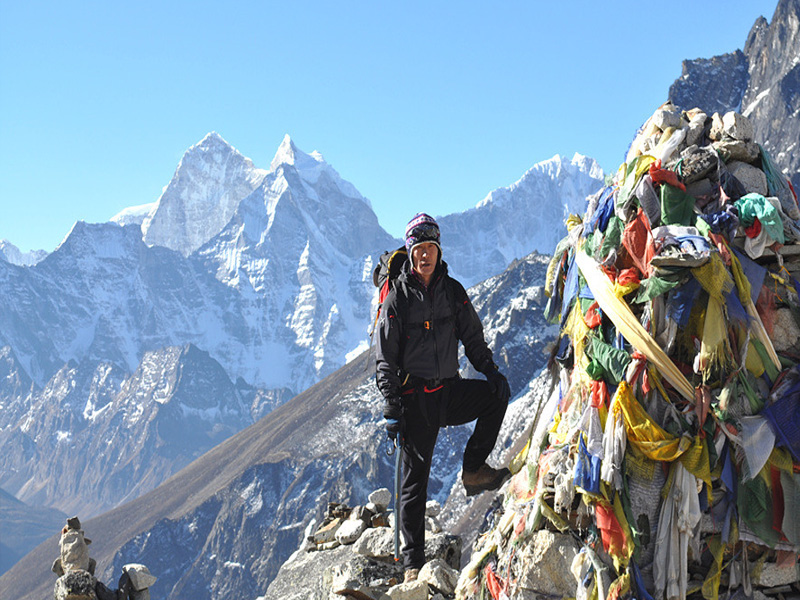
Imja Tse, better known as Island Peak, is a mountain in Sagarmatha National Park of the Himalayas of eastern Nepal. The peak was named Island Peak in 1951 by Eric Shipton’s party since it appears as an island in a sea of ice when viewed from Dingboche. The peak was later renamed in 1983 to Imja Tse but Island Peak remains the popular choice. The peak is actually an extension of the ridge coming down off the south end of Lhotse Shar.
Imja Tse summit was first climbed in 1956 by a Swiss team as a training exercise in preparation for Mount Everest and Lhotse.
Imja Tse is the most popular of Nepal’s so-called trekking peaks given its difficulty (alpine PD+) and accessibility especially when supported by a climbing guide and is the most frequently climbed peak in the Himalaya.
DETAIL ITINERARY
Day 01: Arrival in Kathmandu
Upon arrival at the Tribhuvan International Airport (TIA), you will be welcomed by our representative and taken to one of the best hotels. During your stay in Kathmandu, you will be visiting Buddhist stupas and Hindu temples and shrines which reflect ancient local traditions and arts and culture. In the evening delicious traditional Nepali well come dinner awaits for you.
Day 02: Fly to Lukla (2800m) and trek to Phakding (2800m)
Today, we take early flight from Tribhuvan International Airport (TIA), Kathmandu . Upon landing at Lukla Airport (2800m), we would be going to a hotel and do refreshment and go for lunch. After having lunch, we proceed towards Phakding (2800m). Our trail penetrates the beautiful village Lukla. We meet the intersection of the Jiri trail at Chablung and go through the trail following the Dudh Kosi north through the village of Ghat and then finally reach Phakding where we will spend the very night.
Day 03: Phakding – Namche Bazaar (3440m)
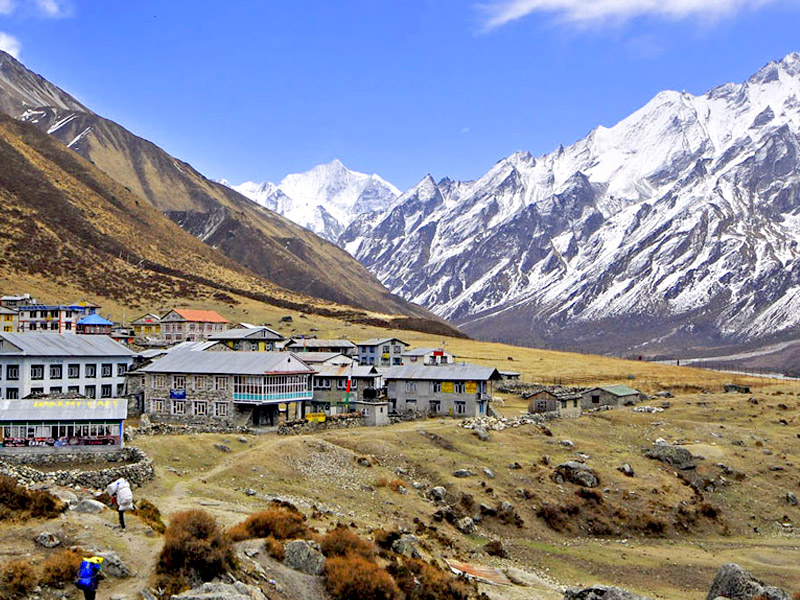
We start our trek from Phakding and reach Namche Bazar in the late after noon. Our trail to Namche Bazar continues north up the Dudh Kosi Valley.The trail leads us to Jorsale (2810m) where we enter the Sagarmatha National Park, and submit our trekking permits for checking. From here, we continue on an ever-steepening trail to Namche Bazaar (3440m). En route we cross the spectacular suspension bridge high above the confluence of the Bhote Kosi and the Dudh Kosi, and shortly after glimpse our first view of Everest, way off to the north-east. The trail to Namche is steep and long, but eventually we reach the remarkable Sherpa capital perched high on the hillside and dominated to the east by the immense bulk of Kwangde (6187m).
Day 04: Acclimatization in Namche
Acclimatization is important before trekking to higher altitude. We spend the day by taking a side trip to Thami or Khumjung visiting the National Park Visitor Centre on the hill above Namche or by simply resting and browsing in the shops in the town. Namche is a fascinating place simply to ‘hang out’ and take in the culture of the mountains, from the trading of visiting Tibetans to the stories of departing mountaineers.
Day 05: Namche Bazar – Phortse Thanga (3500m)
We start our trek from Namche heading north-east on a direct line to Everest. Ahead of us we can see one of the most beautiful mountains in the Khumbu – Ama Dablam (6856m), as well as Everest still far off in the distance. At Sanasa we branch off the Everest trail and head up the hill to the small settlement of Mong where we stop for lunch. From here it is a steady descent to the Dudh Kosi at Phortse Thanga (3500m). This is a beautiful riverside settlement and is our camping spot for the night.
Day 06: Phortse Thanga – Dole (4200m)
It is our turn to move ahead from Phortse Thanga to Dole. Our trail initially climbs steeply out of the valley through rhododendron forest and then continues high above the Dudh Kosi, steadily gaining height. We pass through the settlements of Tongba (3950m) and Gyele (3960m) and eventually reach our camp site for the evening at Dole (4200m).
Day 07: Dole – Machhermo (4410m)
We have been gaining altitude daily. Hence, we must check our blood concentration in time to time to avoid adverse effect in our health. Our trail keeps on continuing high above the west bank of the Dudh Kosi and we obtain tremendous views of the mountains at the northern end of the valley, including Cho Oyu, as well as back down the valley to Ama Dablam, and across the valley to Tawachee and Cholatse. Machhermo at 4410m is a pleasant camp site where we spend our night.
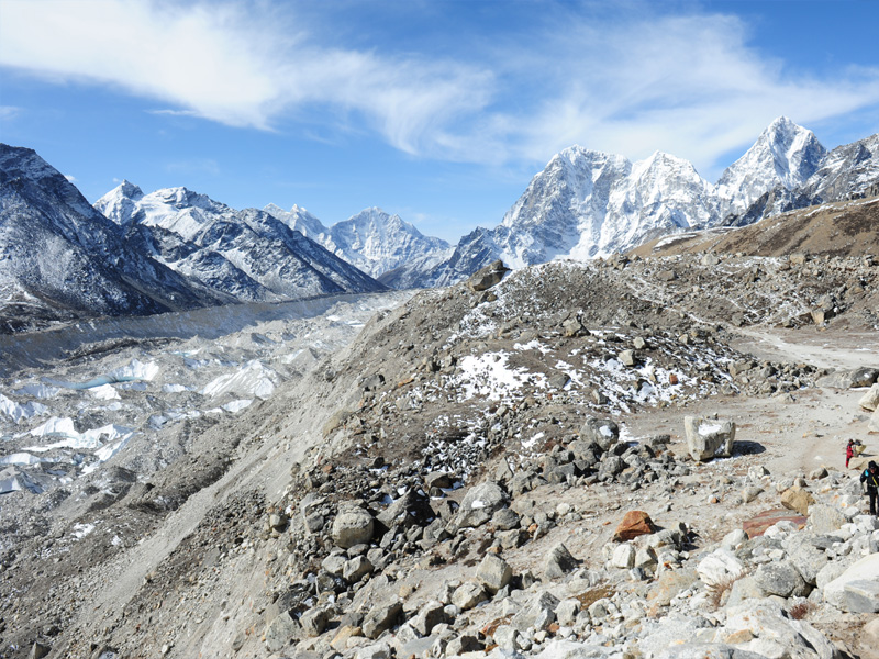
Day 08: Machhermo – Gokyo (4750m)
The valley widens beyond Machhermo and the trail passes through the settlement of Pangka before des